Atlas of the Middle East migration
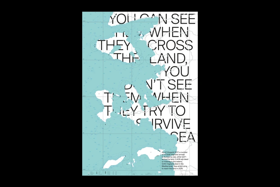
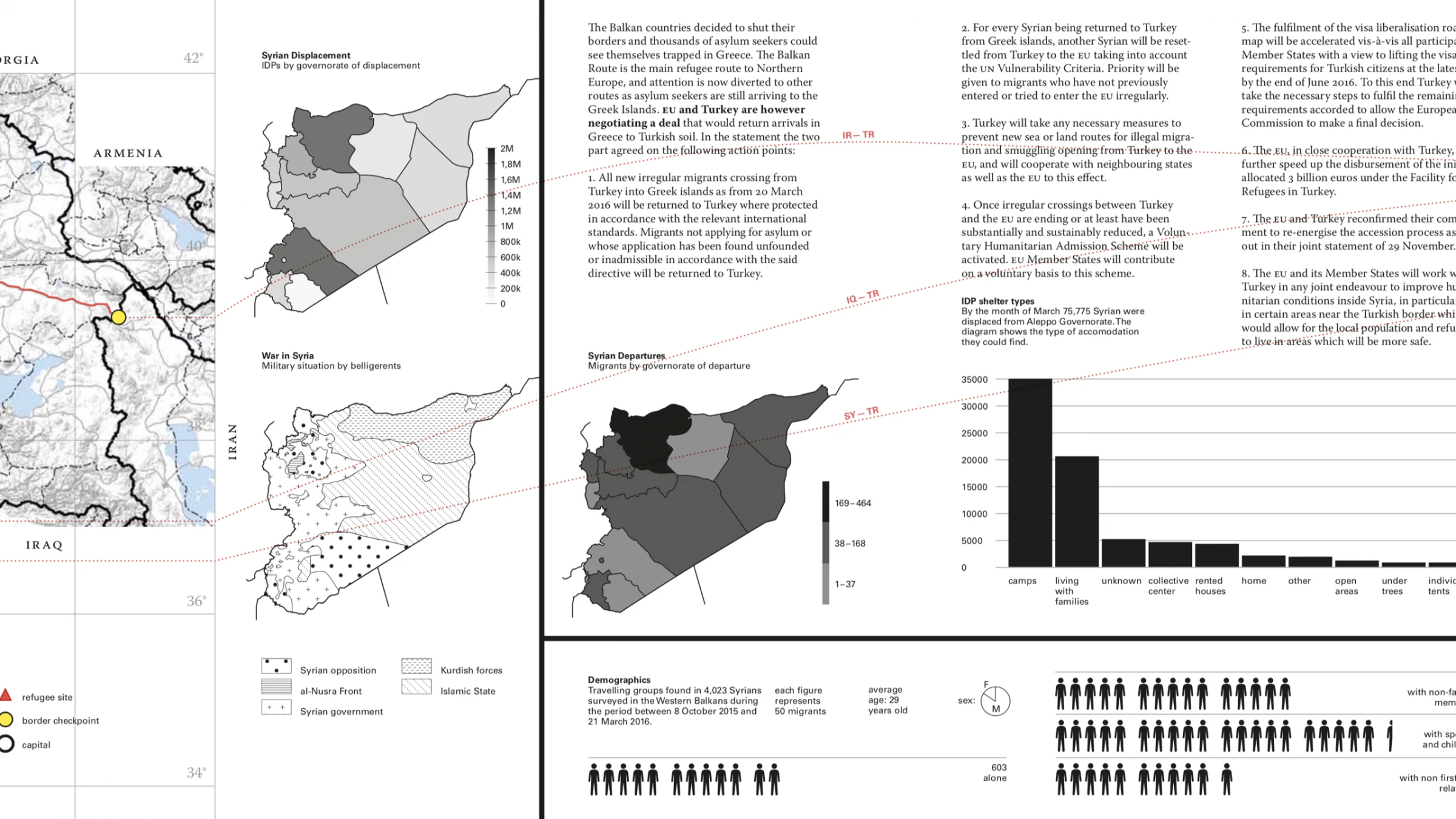
This atlas aims to explain the Middle Eastern migration that significantly increased in 2015 and 2016, leading to an unsettling of the political situation in Turkey, Greece and the Western Balkans. Fast changes, both political and military, make it hard to compare collected data. The reader can follow the orientation of the migratory flow, from the right to the left (Pakistan → Slovenia) and view pictures, diagrams, maps and text in order to gain a multimodal understanding of the situation. Each map was edited with a style sheet in Mapbox, using the cylindrical projection of Mercator which preserves all direction on the plane, and the work was undergirded by the studies of Jaques Bertin in Sémiologie Graphique (1967). Through the disclosure of the elements along the 13-meter leporello, the reader can more easily understand why migrants and refugees flee their countries. The purpose is to clearly articulate what it means to face several conflicts, boundaries, laws and host countries at the same time.