Sea Routes
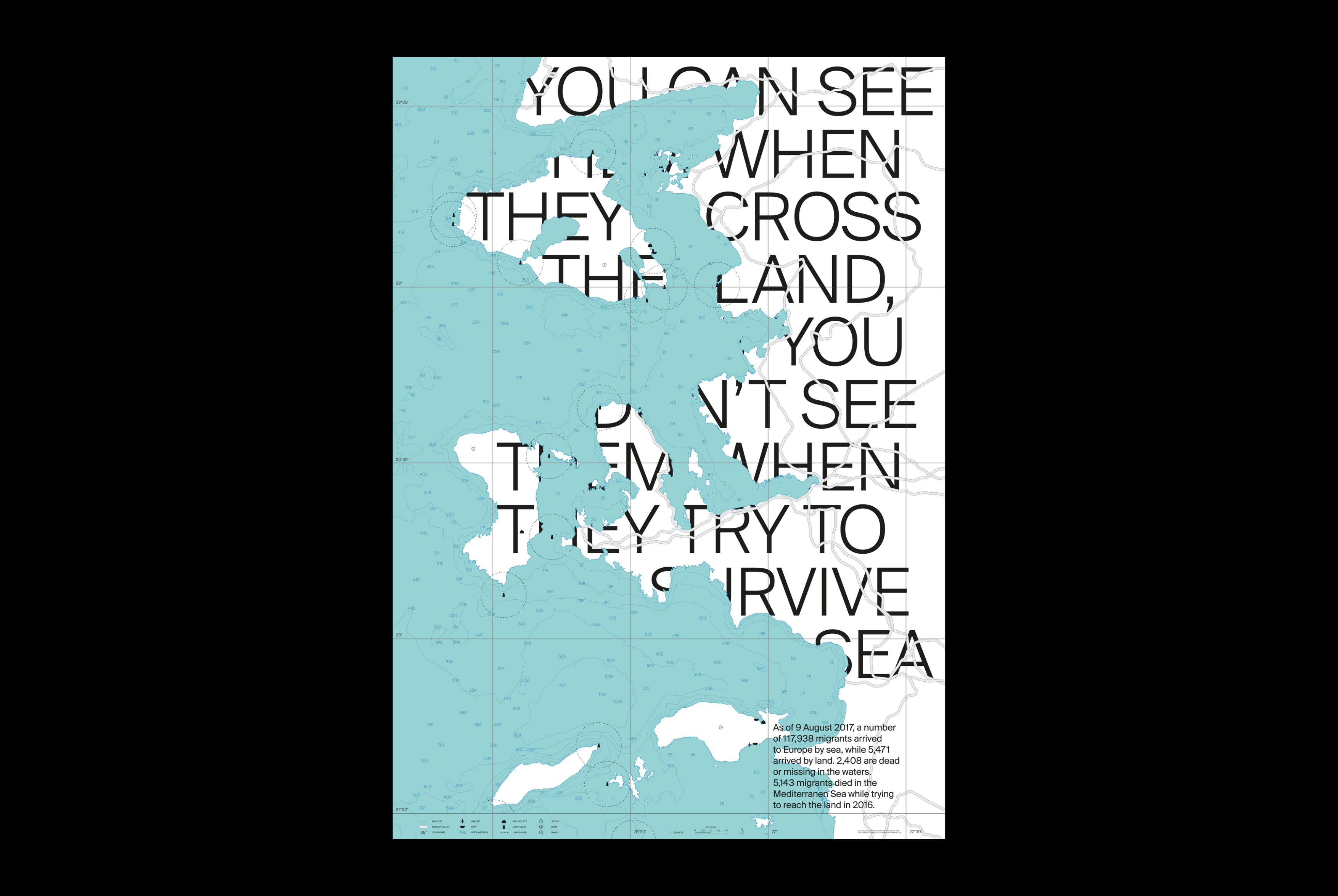
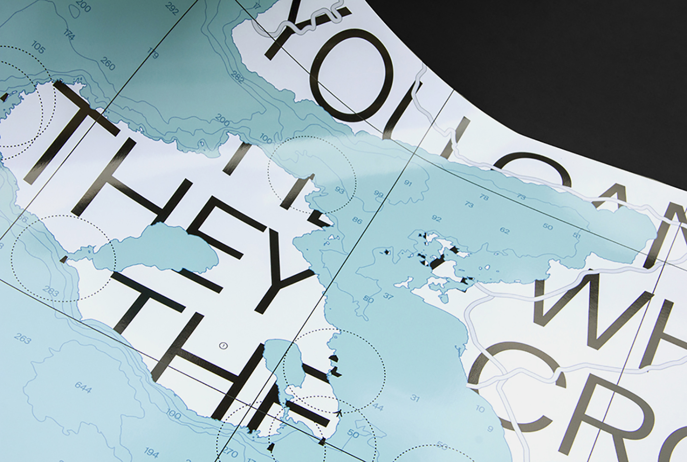
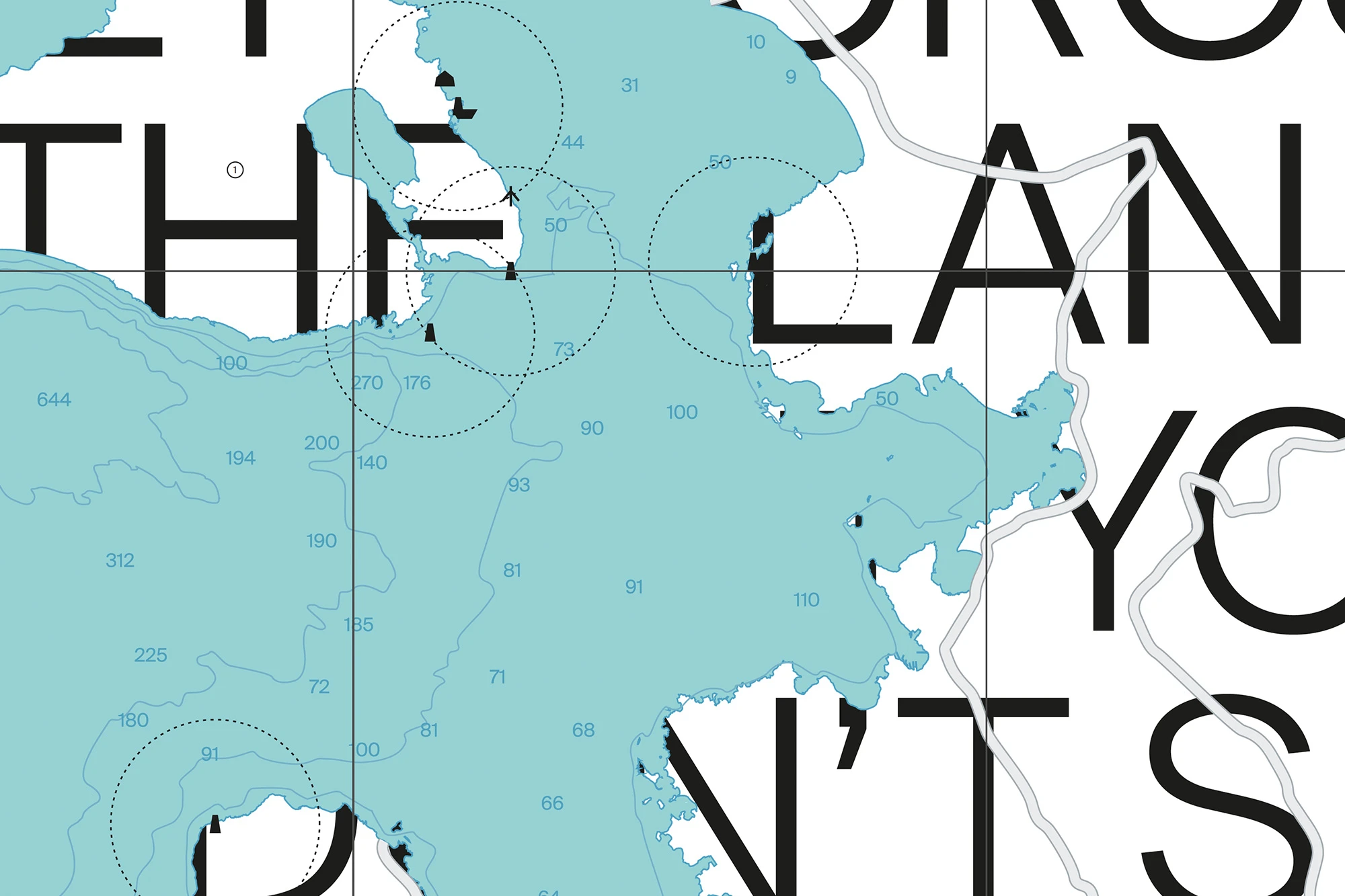
This poster aims to increase awareness of migrant sea routes. Media often portray migrants crossing land or being rescued in the waters, but what is often missed is the journey in between, taking place above the depths of the sea. The hidden typography here represents this gap using a map of the three most crossed Greek islands: Lesvos, Chios and Samos. Maperitive and OpenStreetMap were used as editors to get a vector map with geospatial data, while Illustrator was used to design it. Sea depths and lighthouse locations are taken from the Navionics nautical charts. The data concerning migrants was taken from the website of the International Organization for Migration. This poster has been selected for the Graphic Design Festival Scotland exhibition at the National Centre for Design and Architecture, a showcase and celebration of contemporary poster design from around the world.